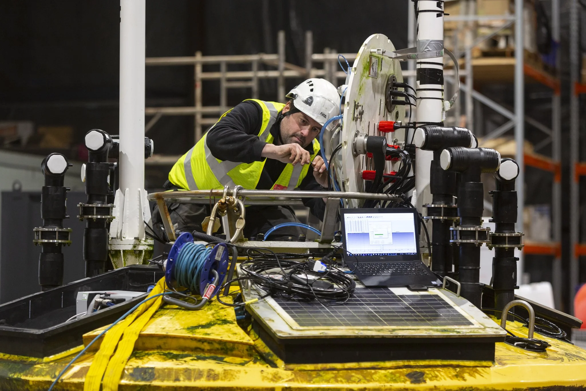
Another commission from BP as they work on the development of the Mona and Morgan Irish Sea wind farms. This time I was taking photographs to document the maintenance of one of their Fugro Seawatch LiDAR buoys which are surveying the field to find optimal wind turbine locations. The Seawatch buoys run on solar panels and fuel cells using methanol fuel. Although autonomous in the field the buoys need to be towed to shore for refueling and servicing.
As an ex-engineer with a background in Physics, this was a really interesting - if freezing! - few days shooting in Liverpool.
LiDAR, or Light Detection and Ranging, can measure wind speed by using the Doppler effect. The Doppler effect is a phenomenon that occurs when the frequency of a wave changes as the source of the wave moves relative to the observer. This effect is commonly experienced in everyday life, for example, the change in pitch of a siren as an ambulance approaches and then passes by.
In the context of LiDAR, a laser beam is directed towards the atmosphere, and the reflected light is detected by a sensor. As the laser beam passes through the atmosphere, it interacts with particles in the air, such as dust or water droplets. These particles scatter the laser beam in different directions, and some of the scattered light returns to the sensor.
By analyzing the scattered light, LiDAR can detect the movement of air particles and calculate wind speed. The movement of the particles changes the frequency of the scattered light, and this change in frequency is detected by the sensor. The amount of frequency shift is proportional to the wind speed, allowing LiDAR to calculate the wind speed with high accuracy.
LiDAR can also provide information about the direction and turbulence of the wind, helping to identify potential challenges for wind turbine installations. This information is particularly useful in the development of wind farms, where accurate wind measurements are essential for identifying the most suitable locations for wind turbines.


